
WBBSE Chapter 6 Satellite Imagery And Topographical Map
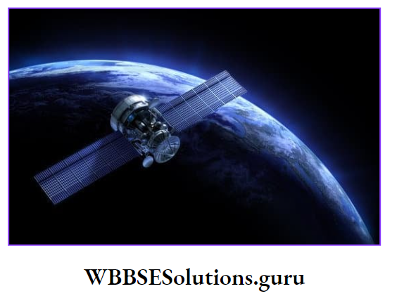
Satellite imagery consists of images of Earth or other planets collected by satellites. Imaging satellites are operated by governments and businesses around the world.
It is part of Remote sensing and is actually scanning of the earth by satellite or high-flying aircraft in order to obtain information about it.
Remote sensing is the acquisition of information about an object or phenomenon without making physical contact with the object.
It refers to Arial sensor technologies to detect and classify objects on Earth by means of propagated signals.
WBBSE Notes For Class 10 Geography And Environment
General Concept Of Satellite And Topographical Map :
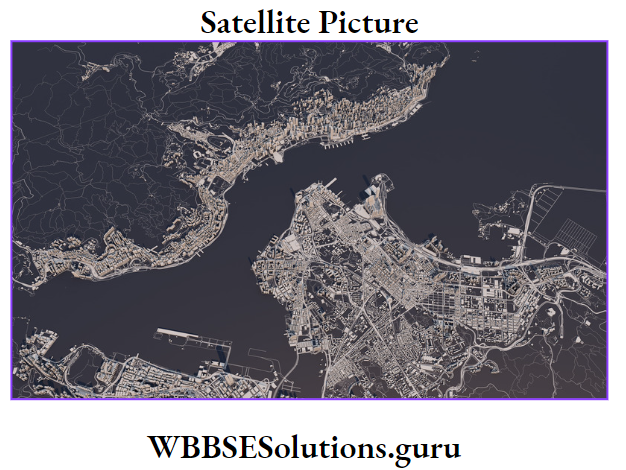
The artificial satellites placed in orbits in space are attached with high-power cameras or sensors. It collects images of different parts of the earth. These images are known as Satellite images.
Some parts of the sunrays reflected back to space. During the images taken from satellites, these reflected sunrays are used as electromagnetic radiation by the camera or sensor.
Topographical Map
Topographical maps are prepared on the basis of detailed su
very of physical (relief, river) and cultural (settlement, transport) elements of our region and shown with conventional signs and symbols drawn to a scale.
Topographical maps, thus depend on primary data collected by surveying.

WBBSE Chapter 6 Satellite Imagery And Topographical Map Differences Between Satellite Imagery And Topographical Map

WBBSE Chapter 6 Satellite Imagery And Topographical Map Uses Of Different Types Of Scale On Topographical Map
To survey every part of India, Survey of India has divided our country into three divisions according to scale.
WBBSE Class 10 Geography Important Questions
Large Scale Division
A survey of India has divided India into 135 grids based on 4° latitudes and 4° longitudes. These are large-scale maps and their scale is 1 cm to 10 km (RF = 1: 10,00,000). This is known as the Million sheet map. Example. Grid No. 64.

Medium Scale Division
Each degree of the large-scale map (4° x 4°) is divided into 16 grids (1° x 1°) which are marked from Letters A to P of the English Alphabet.
The scale of this type of map is 1 cm to 2.5 km (R.F. = 1: 25,0000). These are known as Degree Sheets. Example. One small grid of No. 64 grid is D (64D).
Class 10 Geography Environment Notes Pdf
Small Scale Division
1° is again subdivided into 16 grids (15’x15′) which are marked from 1-16 digits. The scale of this map is 1 cm to 2 km (R.F. = 150,000). These are known as 15′ (Fifteen minutes) sheets. The smallest grid of 64D is 4. So Index No. of the map is 64 D/4.

WBBSE Chapter 6 Satellite Imagery And Topographical Map Steps In Acquisition Of Satellite Image
Processes of preparing satellite images from information collected by artificial satellites involve the following steps:
First Step:
In this step, an artificial satellite consisting digital camera or sensor is placed at a specific height above the earth’s surface.
Second Step:
Sensors collect sunrays reflected from various objects and store them in digital form in different Bands on the basis of their Brightness Value (intensity).
Third Step:
Collected digital information is then transmitted to the Ground station and propagated through different impulses.
Fourth Step:
Errors, if any, defects in the information are corrected and images are prepared from that modified information based on the new Brightness Value (intensity).
Fifth Step:
With the help of a Geographical Information System (GIS), various geographical maps like agricultural maps, forest maps, and soil maps are prepared from those images.
WBBSE Class 10 Geography Solutions
The colour of different objects is expressed in another colour in a satellite image. This is known as False Colour Composite.
The blue colour of an object changes to green, green changes to red and red changes to infrared colour in satellite images.
WBBSE Chapter 6 Satellite Imagery And Topographical Map Characteristic Of Satellite Image
Important features of satellite images are :
Satellite images are prepared by information collected by artificial satellites placed in space.
- This is a high-tech system.
- Satellite images are prepared according to a definite scale.
- Latitudinal and longitudinal extents are marked on satellite images.
- The collection of information on date and time is mentioned on the map.
- The diversity of landforms is expressed in definite colours. The dense forest is represented by deep red colour, green field is expressed by a reddish tint.
- a yellow paddy field is represented by darkish red, marshy land is represented by sky blue, fallow land (laterite) is represented by green colour, and rivers and ponds are represented by deep blue colour.
- Agricultural land and settlements are of geometric shapes like circular, square, rectangle etc.

WBBSE Chapter 6 Satellite Imagery And Topographical Map Uses Of Satellite Image And Its Importance
In the modern age satellite images are very important and widely used :
- One satellite image gives an idea of a vast region (30,000 sq. km).
- It saves time as well as money.
- As information is expressed in digital numbers, these are easily used on computers.
- As these images are prepared repeatedly within 16 to 22 days, changes in the objects are easily identified.
- Sudden changes in weather conditions are easily depicted in satellite images. So, the weather forecast is accurate.
- The location of resources is identified in this map. So investigation of minerals becomes easier.
- Information regarding the conservation of resources, forestry, regional planning, the latest position in wars, changes in the river course, and landslides are identified accurately. Proper planning may be taken in time.
Class 10 Geography Chapter 6 Notes
Comparison Of Satellite Image And Topographical Map Of the Same Area
To compare both the Satellite image and Topographical map of the same region is shown here side by side :
- To the Southwestern part of the topographical map, there is a forested highland (closely spaced contours represent the highland). That area in the satellite image is
- deep red coloured.
- The rest of the Topographical map is yellow coloured. It is represented by a green colour on a satellite map.
- Water bodies and rivers are shown in light blue colour and settlements are shown in red colour in Topographical map.
- But in a Satellite map water bodies and rivers are represented as deep green colour and settlements as grey or ash colour in Satellite map.